 Bluebird


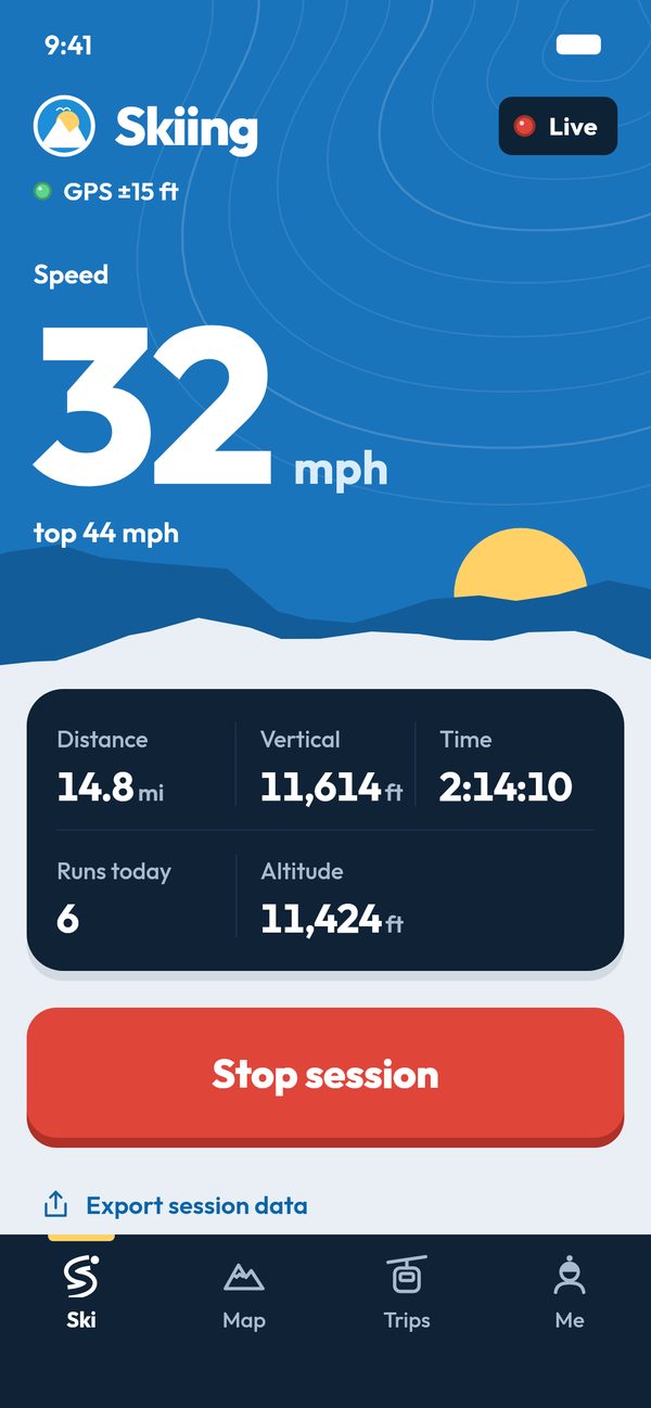
On the Map tab
Your mountain in 3D
The Map tab opens your resort as a 3D model on real terrain: 10 m USGS elevation, the resort's trails coloured by difficulty and named, lift lines with towers and chairs, and trees. During a session it shows where you are.
The new 3D mountains, arriving in an app update, add the village's buildings with named lodges and lifts with moving chairs. What you see below is a preview of that: today's app shows the earlier look.
- Move like a map app. One finger pans, pinch zooms, twist rotates, two fingers up and down tilt. Double-tap zooms in.
- Your layers, your call. Switch trails and lifts on and off, and in the new world buildings too.
- Follow me. Your position and track draw on the mountain as you ski, and the camera can stay on you.
- Prefer flat? A toggle swaps in the flat map of trails and lifts.
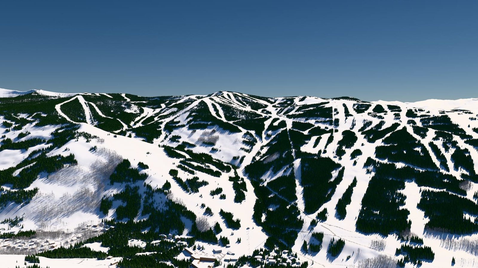 Preview
A preview of the new 3D mountains arriving in an app update: Vail. Until you open it, the picture is a rendering; opening it loads the live viewer once for the whole page.
Vail from the air
Tour the mountain
Flyovers of the 3D Vail shown above, as video.
On the Map tab
Directions on the mountain
Choose where you are and where you want to go. Bluebird Day finds the quickest way over the resort's trails and lifts and draws it on the 3D map. Try it on Vail below.
- Start and finish. Your GPS position, a spot you tap on the map, or a lift bottom or top, a base station or a trail top from the list.
- Set a ceiling. Green only, up to blue, up to black, or anything.
- Off until you switch them on. Transport lifts, riding lifts down, short hikes and moguls.
- A route you can follow. Total time and distance, then step by step: ski this trail, ride that lift, walk to the base.
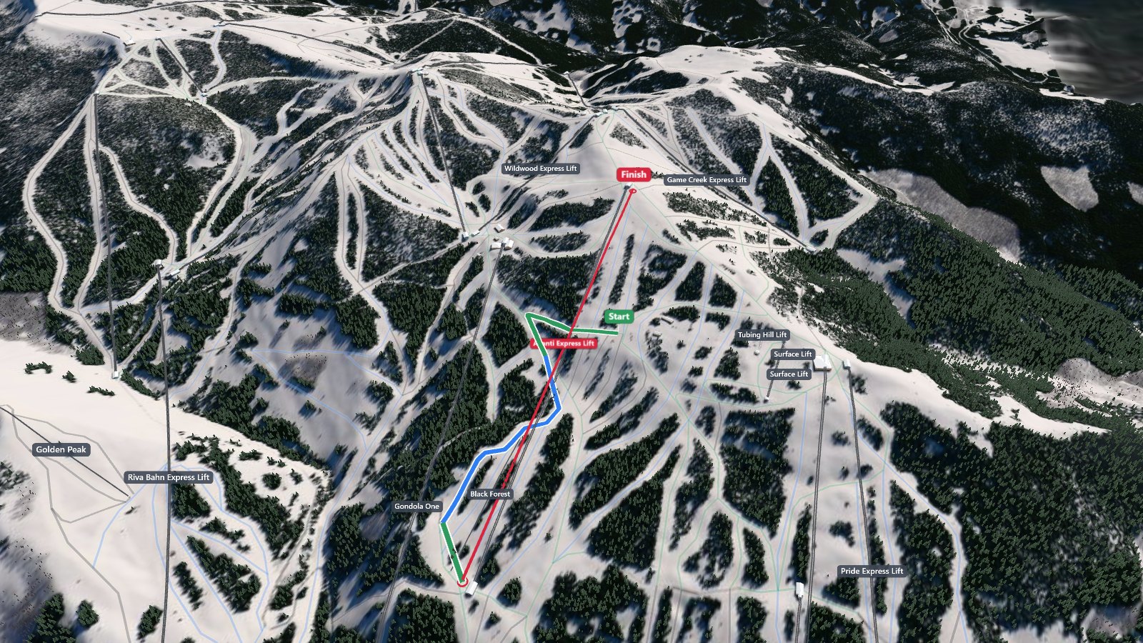
Routes come from the same routing the app uses, on this resort's trails and lifts as mapped in OpenStreetMap. It does not know what is open or closed today.
In Me, in Trips
Replay your day
Open any recorded day in 3D and fly along each run at 1×, 2×, 4× or 8×. The label shows the run's distance, vertical and top speed.
- Stand. Stand at the top of a run and look down the fall line.
- Next run. Step through the day one run at a time.
- Your crew's days too. Open a crewmate's day from the trip's leaderboard the same way.
Everything from the phone in your pocket
Runs and lifts are split automatically from GPS, the barometer and the resort's lift lines. Tracking runs only between Start and Stop.
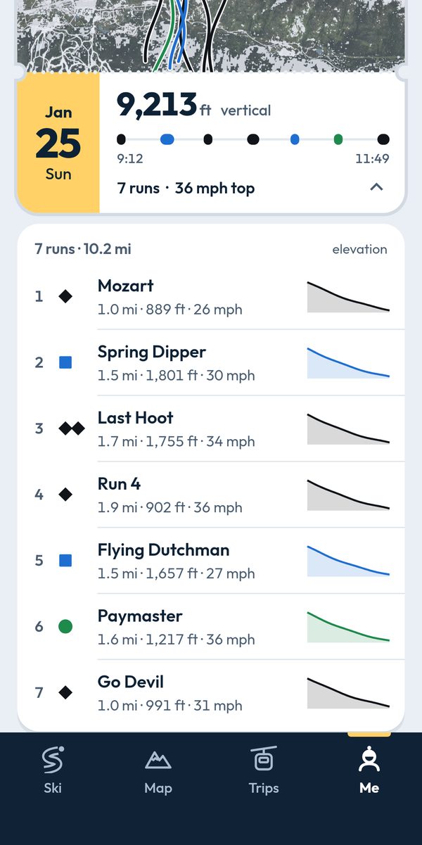
Runs with trail namesVertical, distance and top speed per run. 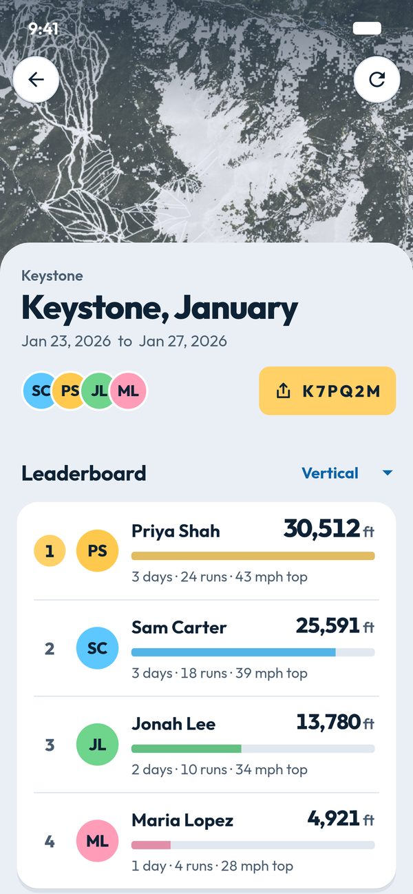
Crew leaderboardShare a 6-character code. Private to your crew. 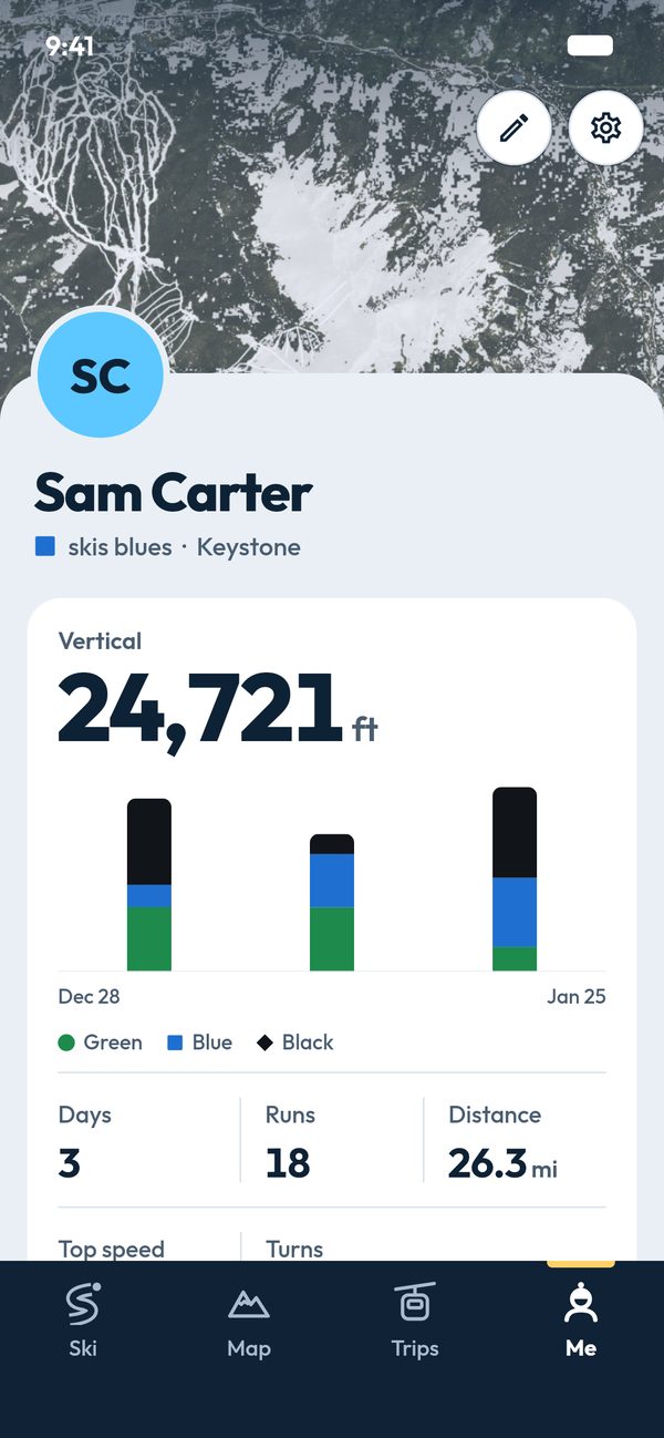
Every day in one placeImport past days from Slopes, Strava, Garmin or any GPX file. 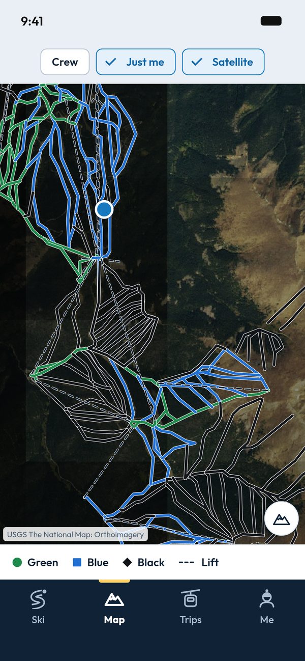
Trails and liftsThe resort's trail and lift lines on satellite imagery.
- Offline resort packsTrails, lifts, terrain and imagery, downloaded once on Wi-Fi
- Big type and high contrastFor gloves and sun glare
- No ads, no analytics, no tracking across apps.Location is recorded only while a session runs.
- Share a dayA card, tall or square, with your stats and a trace of the day's runs.
- Run notificationsA note on your phone when a run is done, or only a summary at the end. Or off.
Resorts you can download
Loading the list
Tap or focus a dot to see its name and zoom to its state. The full list is below the map.
Request your resort
Keystone is built in. Vail, Breckenridge and Beaver Creek are available as downloads, with more on the way. Tell us where you ski and it goes on the list.
Email us your resortOpens your email app. Nothing is stored on this site.
Optional, in private beta
Boot sensors
A boot sensor is a small motion sensor that sits on the power strap of your boot, one per boot. It records how the boot moves all day, keeps that recording, and hands it to your phone over Bluetooth. The phone does the maths after each run.
The app works fine without them. Phone tracking, the 3D views and your crew's leaderboard do not need a sensor.
What you get that a phone in a pocket cannot measure
Each number is for a whole run. These are the names the app uses.
- Edge angleHow far your boots tip onto their edges over the run, typical and steepest.
- Time on a held edgeHow much of the run your edge stays set instead of skidding.
- Left / right balance, boots in stepHow evenly you tip to each side, and how alike your two boots' edge angles are.
- Leg load, jumps, time in the airThe force above standing still, added up over the run, and how long you left the snow.
How it is different
Bluebird Day tells the story of a whole run and a whole trip, and lets you compare it with your crew in a private group. It is not a coach: there is no instruction, no score for individual turns and nothing said in your ear while you ski.
One run, flown along
Sample dataA made-up run on Bwana at Vail, generated for this page. The 3D view, chart, boots and numbers all read the same sample data. It is not a recording and not a promise of any number.Made-up run, not a recording. Everything here reads the same sample data.
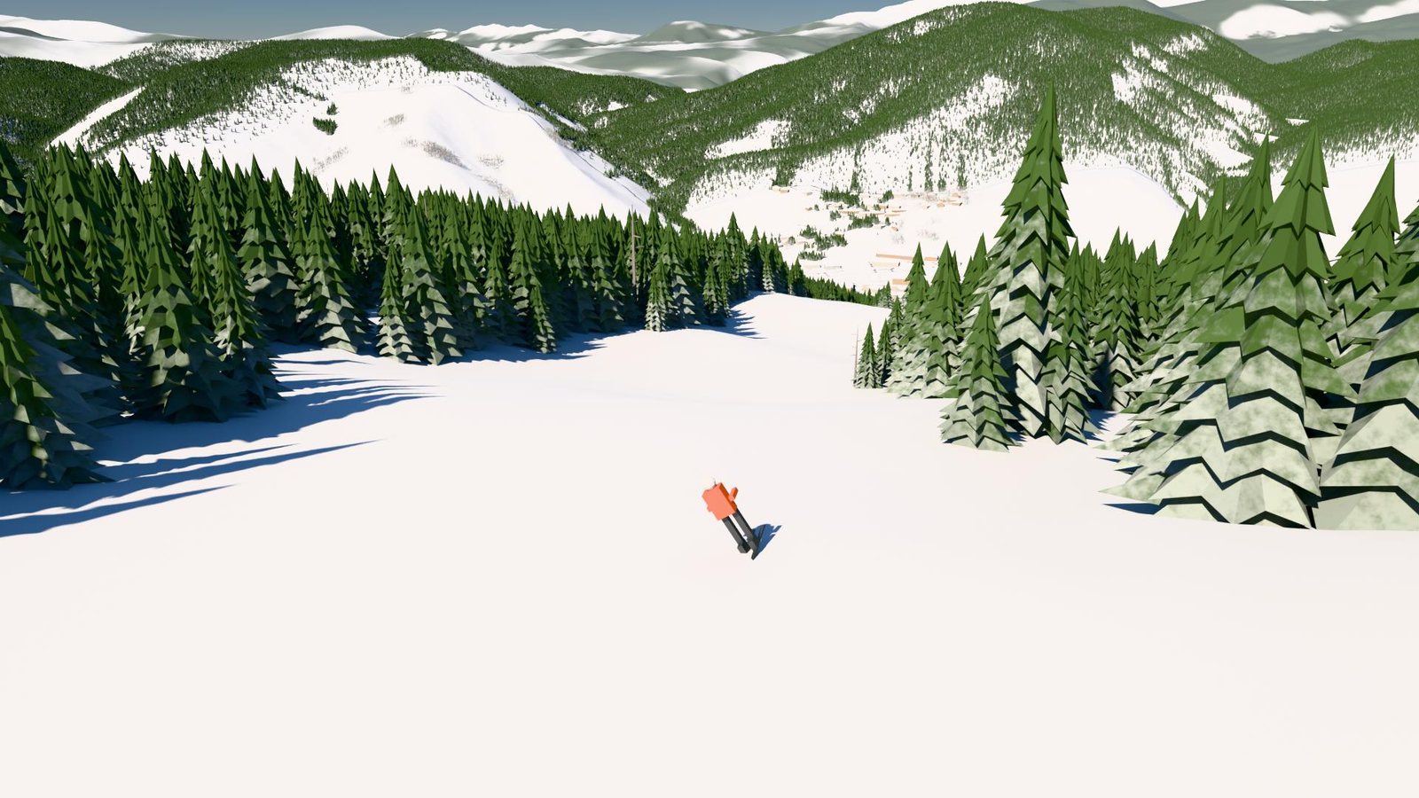
The band is thicker where the two boots differ. Pale stripe: under 15°. Black bar: in the air. Drag the whole-run strip to move.
A held edge is one that stays set for half a second or more. Every number is for the whole run.
Sample data. Only Sam's numbers come from the run above; the others are made up.
Join the waitlist
Optional Bluetooth sensors that clip to your boot are in private beta. Leave your email and we will write when there is news. No date or price yet.
Only for sensor news. We do not share your email.